
REVIEW · HIKING & TREKKING
Discovery hike along the Trondheimsfjord
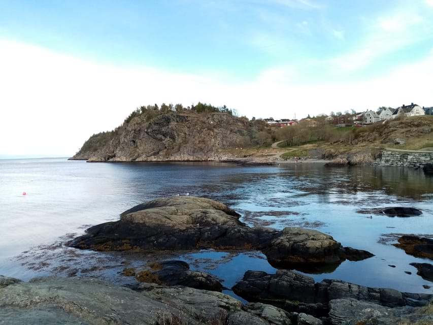
The fjord is Trondheim’s best walking companion. This 6-kilometer hike follows the Ladestien coastal path from Korsvika to Rotvoll, mixing open views, small beaches, World War II remains, and stories about local life. I especially like the one-way route, which keeps the outing moving, and the steady blend of nature and city history. The guide, Gaël, also brings a warm, personal touch in English or French.
The main consideration is the medium difficulty and the lack of a return to the starting point. You need comfortable shoes, clothing suited to changeable Norwegian weather, and enough energy for two and a half hours outside. At $72 per person, it is good value if you want more than a simple walk and appreciate having a guide explain what you are seeing.
In This Review
- Key points about the Ladestien hike
- Why this 2.5-hour walk adds something different to Trondheim
- Starting at Korsvika beside the Trondheim Fjord
- From Korsvika to the Østmarka German bunker
- Ladekaia and the rhythm of coastal Trondheim
- Sponhuset and the coastal scenery
- Devlebukta, beaches, and the final stretch
- Finishing at Rotvoll instead of returning to Korsvika
- What the guide adds to the $72 price
- Who should book this Trondheim Fjord hike?
- Should you book the Ladestien experience?
- FAQ
- How long is the hike?
- Where does the hike start?
- Where does the hike finish?
- Is the hike a loop?
- How do I reach Korsvika from central Trondheim?
- How do I return to the city after the hike?
- What languages does the guide speak?
- What should I bring?
Key points about the Ladestien hike
- A 6-kilometer coastal walk: The route takes about 2.5 hours and follows the Trondheim Fjord rather than returning to Korsvika.
- Six useful stops: You pause at Korsvika, the Østmarka German bunker, Ladekaia, Sponhuset, and Devlebukta before finishing near Rotvoll.
- History beyond the postcard views: The walk includes World War II ruins and explanations about Trondheim’s past.
- A practical public-transport outing: Bus 2 reaches the start, while bus 20 connects the finish with central Trondheim.
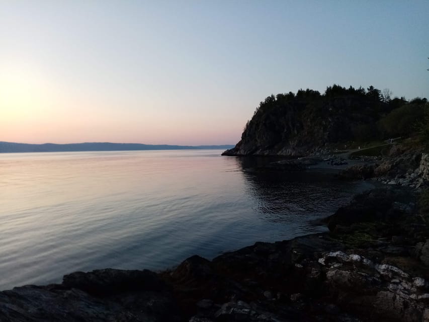
- A calm taste of local life: Beaches, coastal paths, outdoor habits, flora, and fauna make this feel more like an ordinary Norwegian day than a standard city tour.
- Small-group flexibility: The walk can continue even with only one participant, and the route can be adjusted to suit the group.
Why this 2.5-hour walk adds something different to Trondheim
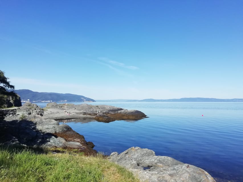
Trondheim is easy to explore on foot, but its center tells only part of the story. The Ladestien gives you a look at the city from its coastal edge, where the fjord, wooded stretches, beaches, and old military remains share the same route.
I like this kind of outing because it does not force you to choose between scenery and information. You get wide views across the Trondheim Fjord, but the guide also gives the places meaning. A bunker is not just a concrete structure. A beach is not only a photo stop. The route connects these sights to Trondheim’s wartime past, its natural setting, and the way people use the coast today.
The pace is described as relaxing, yet the distance is enough to feel like a real walk. Six kilometers in around two and a half hours allows time for explanations and photographs without turning the outing into a race. You should still expect regular walking, some uneven ground, and outdoor conditions throughout.
Gaël leads in English or French and is known for creating a friendly, reassuring atmosphere. His explanations cover local history, politics, Norwegian life, flora, and fauna. That range matters. You are not simply hearing a list of dates, and you are not being asked to admire scenery without context.
More Hiking Tours in Trondheim:
- From Tromsø: Snowshoeing Hike with Picnic Lunch and Photos
★ 4.8 · 637 reviews - From Tromsø: Guided Husky Snowshoe Hike and Husky Camp Visit
★ 4.9 · 555 reviews - From Tromsø: Snowshoe Hike in the Arctic
★ 4.9 · 467 reviews
Starting at Korsvika beside the Trondheim Fjord
The hike begins at the Korsvika parking lot on the Lade peninsula. This is a practical starting point because it is close to public transport, yet it quickly puts you beside the water and away from the feel of the city center.
From central Trondheim, take bus number 2 toward Strindheim and get off at Ingemann Torps vei. The bus runs about every 10 minutes, and the parking area is less than a five-minute walk from the stop. That makes the start fairly simple, even if you do not have a car.
Look for the guide holding a sign for Gaël & Maëlle Travel. You should tell the guide as soon as possible if you are running late, since this is a one-way walk and the group will be progressing along the route.
Korsvika itself provides the first chance to pause for photographs. The appeal here is immediate: the route begins with the fjord in view, so you get your bearings before the walking picks up. It is also a good place to check your clothing, shoes, and water before committing to the full distance.
From Korsvika to the Østmarka German bunker
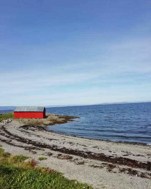
The first section introduces the character of the Ladestien. You walk along the coast with changing views and occasional points where the guide stops to explain the setting. The path is not simply a direct march from one attraction to the next. Its value comes from the way the coast keeps changing as you move.
The Østmarka German bunker is one of the more unusual stops. World War II remains can be easy to overlook when they sit among trees and coastal scenery, so having the guide explain their role gives the site weight. You get a concrete reminder that this peaceful shoreline also has a military past.
This stop is especially useful for anyone who wants some historical substance during a nature outing. The tour does not treat Trondheim’s past as a separate subject confined to museums. Instead, history appears where it happened, along the peninsula and beside the fjord.
Expect another photo pause here. The bunker adds visual variety, while the nearby views keep the stop from feeling like a purely historical visit. If your main interest is architecture or military history, the ruins are likely to be a highlight. If you prefer uninterrupted walking, the explanations do add time, but that is part of what you are paying for.
Ladekaia and the rhythm of coastal Trondheim
Ladekaia offers another natural break in the walk. The name is closely tied to Trondheim’s waterfront, and the stop gives the route a more lived-in feel after the quieter stretches around the bunker.
This is where the idea of a Norwegian outdoor lifestyle becomes clearer. The walk is not staged around one grand monument. It uses an everyday coastal path, with people making use of the shoreline, open air, and views. That is a valuable contrast to a standard city sightseeing route, particularly if you have already spent time around Trondheim’s central streets.
The guide may also arrange a short stop at an old café if the timing suits the group. This is not presented as a guaranteed part of every walk, so you should not book the tour solely for the café. Still, it is a pleasant possibility and fits the unhurried character of the outing.
At Ladekaia, I would keep your camera ready but also listen closely. The tour’s strongest moments come from the link between place and explanation. You are not only collecting pictures of the fjord. You are learning how the coast fits into Trondheim’s story and present-day life.
A few more options to weigh up in Trondheim
- Trondheim Like a Local: Customized Private Tour
★ 4.7 · 92 reviews - Trondheim : Explore the city of kings with a local guide
★ 4.8 · 70 reviews - Trondheim: 2-hour City Walking Tour
★ 4.2 · 51 reviews - Trondheim: Discover the city of kings with a local guide
★ 5.0 · 41 reviews
Sponhuset and the coastal scenery
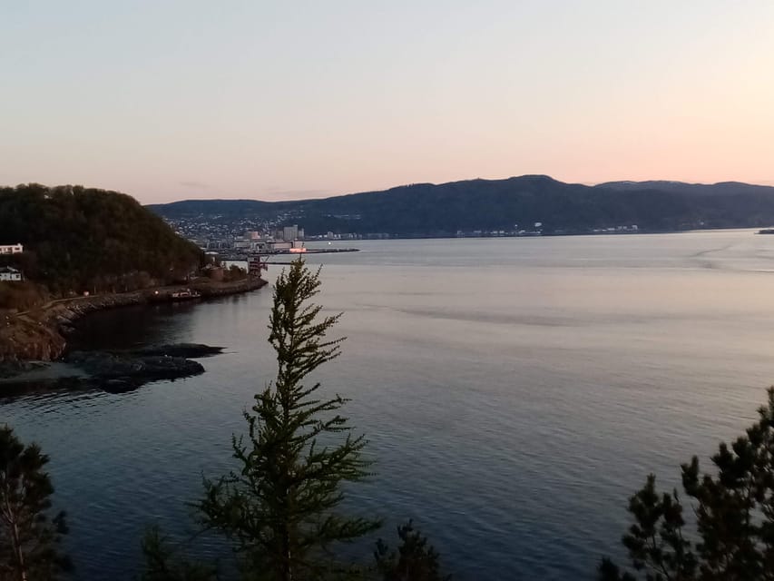
Sponhuset is another marked photo stop along the route. By this stage, the walk has established its pattern: move along the coast, pause at an interesting point, and hear a short explanation that adds context to the view.
The scenery is the star here. You may find open water, shorelines, and changing views across the fjord, with the Lade peninsula providing a mix of natural and historic interest. The word medium is important. This is not described as a strenuous mountain hike, but it is also not a flat, paved city promenade suitable for everyone.
Comfortable shoes are essential. The tour takes place outdoors from March through October, and Norwegian weather can change quickly. A mild morning can become wet or windy, so waterproof layers and sensible footwear are a better choice than city shoes. The walk is not suitable for wheelchair users.
Sponhuset also helps break up the distance. Rather than watching the clock and wondering how much farther you have to go, you get several known points along the way. That makes the 6-kilometer route feel manageable, especially when the guide keeps the group engaged.
Devlebukta, beaches, and the final stretch
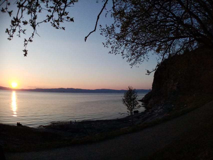
Devlebukta brings the hike back to one of its central pleasures: the beach. Coastal walks can sometimes become repetitive, but a beach gives you a different texture and a natural reason to stop.
This is a good point to appreciate the balance of the route. You see wartime remains, local gathering places, coastal scenery, and beaches in one outing. The stops are not identical, and the walk does not depend on one famous attraction to justify the price.
The guide also discusses the flora and fauna of the Lade peninsula. The information is useful because it encourages you to pay attention to details along the path. You may begin noticing more than the water and the horizon, although the exact plants and animals seen can vary with the season and weather.
By Devlebukta, you should be aware that the walk still has a finish ahead. The total distance is 6 kilometers, and the route remains outdoors until Rotvoll. Take a drink and dress for the full time, not just the weather at the starting point.
Finishing at Rotvoll instead of returning to Korsvika
The walk ends at Rotvoll, which is an important practical detail. This is not a loop. You finish in a different part of Trondheim, so you need to plan your return from there.
The Rotvoll bus stop is about 10 minutes from the end point. From there, bus number 20 toward Romolslia can take you back toward the city center. Buses run every 15 to 30 minutes, so you may have a short wait. The official AtB app is the best tool for current timetables and ticket purchases.
I see the one-way format as both a benefit and a small inconvenience. You cover more coastline and avoid retracing your steps, which makes the experience feel like a genuine journey. On the other hand, you need to keep track of two transport points rather than simply walking back to where you started.
The route is well suited to independent visitors who are comfortable using local buses. If you want a tour that begins and ends in the same central location, this is not the right choice. If you like seeing more of a city and do not mind a short bus connection at each end, the arrangement works well.
What the guide adds to the $72 price
At $72 per person, the tour costs more than taking a public bus to the Ladestien and walking it alone. The comparison is fair, but it misses the main value. You are paying for a local guide, a planned route, historical interpretation, nature information, and the convenience of seeing several points without researching them yourself.
Gaël’s contribution is especially important. His style is described as attentive, enthusiastic, and good at adapting the route to the group. The walk can continue even when only one person books, which is useful if you are visiting outside the busiest season or prefer a quieter outing.
The tour also provides a different kind of access to Trondheim. A self-guided walk can give you the views, but it may leave the bunker, beach, and local places disconnected. The guide helps turn separate sights into a story about the peninsula.
I would call the price fair for someone who wants interpretation and company. It is less compelling for a confident walker who only wants exercise and photographs. In that case, using public transport and following the coastal path independently may be the better value.
Who should book this Trondheim Fjord hike?
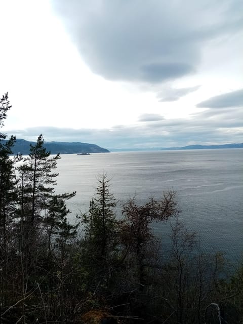
I would recommend it most strongly to you if:
- You want a break from museums and central-city sightseeing.
- You enjoy a moderate walk but do not want a full-day wilderness excursion.
- You care about local history, World War II sites, and everyday Norwegian life.
- You like photography and want several planned stops.
- You appreciate a guide who can speak English or French.
- You are comfortable starting and finishing in different locations.
- You want a small-group experience that can still run with one participant.
Families with older children may also find the distance manageable, but the medium difficulty and unpredictable weather mean you should judge your group’s walking ability honestly. This is not suitable for wheelchair users, and it is not a good match if you need fully accessible paths.
The seasonal window runs from March to October. Spring and autumn can bring changeable conditions, so pack layers and waterproof clothing. Summer may offer easier weather, but the tour remains an outdoor experience, not a weather-controlled activity.
Free cancellation up to 24 hours before the start and the reserve-now, pay-later option make the booking less risky when your schedule is still taking shape. You should still check the available start time and allow enough time to reach Korsvika by bus.
Should you book the Ladestien experience?
Book this hike if you want to understand Trondheim through its shoreline rather than only through its buildings. The combination of fjord views, beaches, the Østmarka bunker, Ladekaia, Sponhuset, and Devlebukta gives you a broad look at the Lade peninsula in a short time.
I especially like the way the route brings together quiet scenery and useful local context. You get a relaxing walk, but you also learn about war, politics, nature, and Norwegian habits from a guide who adjusts to the group.
Skip it if you want a strenuous hike, a loop route, or a tour focused only on major city landmarks. For everyone else, especially those with half a day to spare and comfortable walking shoes, this is a thoughtful and well-priced way to see a less obvious side of Trondheim.
FAQ
How long is the hike?
The hike is 6 kilometers and takes about 2.5 hours.
Where does the hike start?
It starts at the Korsvika parking lot on the Lade peninsula.
Where does the hike finish?
The hike finishes at Rotvoll in Trondheim.
Is the hike a loop?
No. It is a one-way hike with different starting and ending points.
How do I reach Korsvika from central Trondheim?
Take bus number 2 toward Strindheim and get off at Ingemann Torps vei. The parking lot is less than five minutes from the bus stop.
How do I return to the city after the hike?
Walk about 10 minutes from the finish to the Rotvoll bus stop and take bus number 20 toward Romolslia. The bus runs every 15 to 30 minutes.
What languages does the guide speak?
The live guide is available in English or French.
What should I bring?
Bring comfortable shoes and comfortable clothing suited to outdoor walking. Norwegian weather can be unpredictable, so appropriate layers and footwear are important.
Just added in Trondheim
- Trondheim: City Bus Tour★ 4.1 · 31 reviews
- Trondheim: Audio Guide Panorama Bustour★ 4.0 · 9 reviews
- Slegding and tram-tour★ 5.0 · 19 reviews
- Skiing in winter wonderland★ 4.5 · 12 reviews
- Trondheim Private Walking Tour★ 5.0 · 1 review
- Trondheim’s Regalia Self-Guided Tour of Norway’s Historic Centre★ 5.0 · 9 reviews
- City Bus Tour in Trondheim, Norway★ 3.5 · 13 reviews
- See the city power-walk★ 4.5 · 6 reviews
Hiking & Trekking, compared.


Guided Husky Snowshoe Hike and Husky Camp Visit
Read our review →

Preikestolen (Pulpit Rock) Hike with Local Guide
Read our review →

Browse the lists this tour appears in